forum
library
tutorial
contact
State Agencies Outline Concerns Over Dredging Plan
by Mike O'BryantColumbia Basin Bulletin - September 20, 2002
|
the film forum library tutorial contact |
|
State Agencies Outline Concerns Over Dredging Planby Mike O'BryantColumbia Basin Bulletin - September 20, 2002 |
Oregon and Washington government agencies delivered this week to the Army Corps of Engineers their comments on the Corps' plan to deepen the Columbia River shipping channel by three feet.
Reflecting the comments of four state agencies, Oregon Gov. John Kitzhaber endorsed the plan provided environmental issues outlined by three state agencies are addressed.
Missing from Oregon's comments were the opinions of the Department of Environmental Quality, which is still considering a 401 clean water certification for the project, and the Department of Land Conservation and Development, which is still considering whether the plan is consistent with the state's Coastal Zone Management Plan. Also commenting from Oregon are the Department of Fish and Wildlife, Division of State Lands, Department of Geology and Minerals and Economic and Community Development Department.
Similarly, Washington's Department of Ecology said its comments were interim and it still needed to rule on both water quality certification and Coastal Zone Management Plan consistency, but the comments made it clear that the plan as it is now would not meet the consistency requirement. The Washington Department of Fish and Wildlife also sent comments to the Corps.
"The Columbia River navigation channel is important to the state's economic health, serving as a significant conduit for international trade," Kitzhaber said. "Deepening the channel to accommodate fully loaded new-generation deep-draft vessels would continue the Port of Portland's role as a vibrant regional port that makes the world market accessible to the goods grown and manufactured throughout this region."
However, he continued, "we must maintain our important environmental standards to protect fish, wildlife and water quality. Given Endangered Species Act listings and Clean Water Act concerns, it is imperative to ensure the project minimizes and mitigates potential impacts to native salmonids and water quality."
The Corps and the six Columbia River ports of Portland and St. Helens in Oregon, and Vancouver, Kalama, Woodland and Longview in Washington, are proposing to deepen the existing Columbia River navigation channel from near the river's mouth to river mile 106.5 and the lower 12 miles of the Willamette River by three feet, from 40 feet to 43 feet.
Before it sends the project off for approval from Congress, the Corps is required to complete economic and environmental studies of its impacts. The Corps released its draft Supplemental Integrated Feasibility Report and Environmental Impact Statement July 10. This is the second time the Corps has studied the project. It sent its plans off to Congress in December 1999, but had to again consult with federal agencies when the National Marine Fisheries Service rescinded in August 2000 its earlier decision to grant a no-jeopardy opinion of the project. In Sept. 2000, the two states denied the Corps water quality permits and CZMP consistency approval it would need before it could begin the project. NMFS reinstated its no-jeopardy opinion earlier this year. Comments on the draft supplemental reports were due Monday, Sept. 16.
WDFW said the wildlife mitigation proposal contained within the deepening plan would adequately mitigate for disposal impacts, subject to the Corps securing a couple of mitigation sites. The agency calculated that disposal of dredged material would adversely affect 171.4 acres of farmland, 50 acres of riparian land and 15.4 acres of wetlands, a decrease from the 1999 plan. Yet riparian habitat restoration will occur on 212 acres, 4.4 times the impacted acreage; 209 acres of wetland habitat would be restored, 10 times the acreage; other mitigation would total roughly 850 acres.
ODFW said the Corps' adaptive monitoring and management plan is "vague and brief about what this actually entails and ODFW seeks further explanation."
"The ODFW is not confident the Corps will seek and incorporate input from state agencies and stakeholders on actual management and monitoring plans," the letter to the Corps said. "Our concern is based on the fact that ODFW's written comments on the draft and final MCR Ocean Disposal Site Management and Monitoring Plan (MMP) had little if any bearing on the final document."
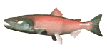
ODFW also reminded the Corps that, despite a positive biological opinion for the project from the National Marine Fisheries Service and the US Fish and Wildlife Service, it must also address lower Columbia River coho, which is listed as endangered by Oregon. It said the state Endangered Species Act standard most relevant to the channel deepening project is water quality, but that won't be known until DEQ completes its 401 Water Quality Certification process later this year.
Ecology, too, said that a state water quality certification would be needed before the project could move forward. While it gave no indication in its comments whether it thought the project would be given the certification, it did say the Corps would not get a CZMP consistency determination without some changes.
"Ecology has previously determined that the impact to sand movement and availability from the proposed dredging and disposal is not consistent with the requirements or intent of the Shoreline Management Act and our State's Coastal Zone Management Program," it said. Among the ways to become consistent with Washington's CZMP, Ecology said a plan is needed to reduce the "loss of sand to the littoral cell to avoid coastal erosion impacts. The plan should identify specific appropriate measures by which coastal erosion is avoided, minimized and/or mitigated."
Both Washington and Oregon suggested the Corps consider more beneficial uses for its dredged materials, such as dumping dredged spoils directly onto eroding beaches, rather into deep water sites that would affect Dungeness crabs. It experimented with such a project this year when it dumped spoils onto Benson Beach, near the river's north jetty in Washington.
Washington, more than Oregon, was concerned about the impact of the project on crabs. WDFW said that crabs are important commercially and recreationally and are a source of food (crab spawn) for coho and chinook salmon. The impact would occur during the dredging operation as crabs are entrained in dredging equipment (crabs travel into the estuary as far upstream as the salinity content is conducive) and when dredged spoils are disposed at some sites.
Perhaps the most critical comment from ODFW is the assertion that two of the Corps' proposed ecosystem restoration projects in the estuary may cause more harm than good. The Corps plans to place dredge spoils in a temporary sump and pump the spoils into an embayment in Lois Island during a November to March in-water work period, creating nearly 400 acres of shallow water habitat. It will also begin a new dumpsite at Miller-Pillar pile dike sites, creating even more shallow water habitat.
ODFW said that the Corps, NMFS and USFW consulted on development of these projects, but that the state had not. "We have serious questions as to their actual restoration value in addition to their impacts on existing natural resources," the letter said.
The Lois-Mott Island fill site is adjacent to the Tongue Point net pen and select area fishery for coho and chinook salmon, which ODFW has funded since 1995 as part of a strategy with Washington to maintain adequate fishing opportunities for the commercial fishing industry in the Columbia River. "The site of the proposed fill is the main area used by fishers in the terminal fishery. We are concerned that the proposal would destroy the fishery all together," ODFW said.
The agency has similar concerns with the Miller-Pillar dike pile project because it would unite Miller Sands with Rice Island, creating a huge dredged spoil island in an area already rife with bird predation issues (Caspian terns). The area is also important to commercial fishing and could fill once the restoration project is complete.
Ecology also has concerns with both projects. It said the Corps' attempt to avoid disposing material at the deepwater site for the first 10 years of the project by placing sand at Lois Island and Miller-Pillar pile dike sites "is not a significant improvement in dredged material management (from a coastal erosion perspective)."
The plan removes sand from "the active transport system," plus it moves sand from downstream in the estuary to areas upstream, Ecology said. "Therefore, the use of these sites reduces the fluvial supply of sand to the lower estuary, likely extracts sand that recently originated from the coastal zone, and increases the capacity of the lower estuary to continue to fill with sand from the coastal zone."
Overall, Ecology said that proposed channel deepening project and 20-year dredged material disposal plan "exacerbates the deficit of sand supply to and within the coastal zone. The impact violates basic policies of sustaining Washington coastal resources and communities."
Finally, ship wakes are likely to increase the incidence of stranding juvenile fish, according to WDFW. The Corps report said that fewer small vessels would decrease stranding, while larger vessels with larger wakes would increase stranding, but with no net increase in the number of juveniles stranded at the river's edge. WDFW disagrees with this assertion, saying that "significant stranding and mortality" results from large vessel ship wakes and that millions of juvenile fish are being stranded now every year.
Related Sites:
Oregon Governor's Office: www.governor.state.or.us
Oregon Department of Fish and Wildlife: www.dfw.state.or.us
Washington Department of Fish and Wildlife: www.wa.gov/wdfw/home
Washington Department of Ecology: www.ecy.wa.gov
U.S. Army Corps of Engineers: www.nwp.usace.army.mil
learn more on topics covered in the film
see the video
read the script
learn the songs
discussion forum